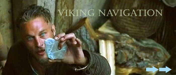
There were several devices that the Vikings used to navigate however we will focus on the fabled "Sunstone".
First here is a list of Viking Navigational Instruments.
More about each one can be found at the bottom of this page.
Viking Navigational Instruments.
- Viking pelorus
- Viking sun stone
- Viking bearing dial
- Viking sun shadow board
- Viking sun compass
- Viking weather vane
The Viking Sunstone
Before the invention of the magnetic compass, navigating with a sundial would have been difficult, particularly on overcast days. Ancient Viking lore suggests that they had a magical tool to find the sun, even when the star was hidden.
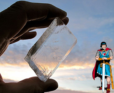
Researchers have now discovered the crystal that would have made such a magical apparatus possible. The Vikings could have used a common calcite crystal, called an Icelandic spar, to find the sun in the high latitudes where they would have had to battle long twilights and cloudy skies to navigate. This special "sunstone" could find the direction of the sun even when it was out of view because it plays a trick with the light.
"The Vikings could have discovered this, simply by choosing a transparent crystal and looking through it through a small hole in a screen," study researcher Guy Ropars wrote in an email to LiveScience. "The understanding of the complete mechanism and the knowledge of the polarization of light is not necessary."
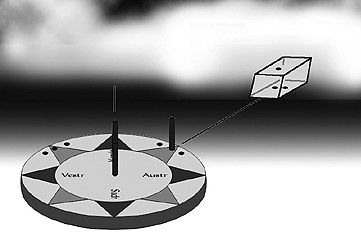
To use the crystal, the Vikings would have held the stone up to the center of the sky (from their perspective). When sunlight hits the crystal, that light gets polarized and broken into an "ordinary" and an "extraordinary" beam.
On a clear day, the Vikings would have rotated the crystal until the two beams lined up. Since these two beams line up and have the same brightness at only one angle, by noting where the sun is when this happens the Vikings could establish a reference point that could be used even when the sun wasn't visible.
Here is a link to a PDF file, entitled - VIKING NAVIGATION USING THE SUNSTONE, POLARIZED LIGHT AND THE HORIZON BOARD by Leif K. Karlsen
that describes, in detail the use of the Sunstone:
Click Here for "VIKING NAVIGATION USING THE SUNSTONE".
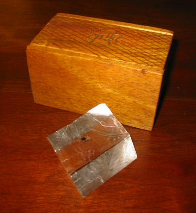
There are several other types of crystal that have this same property, but they wouldn’t have been too useful because they aren't as clear or as common, the researchers said. The Icelandic spar that the researchers analyzed is very common along the coasts of Iceland, and is also common today in Brazil and Mexico.
The real sunstone?
While none of these Icelandic spar crystals has been found in a Viking settlement, one was recently discovered in an Elizabethan shipwreck from 1592 in the English Channel. The researchers are currently confirming that this crystal could have been used to find the sun when it was out of sight, which they think might be true because a large cannon on board the ship would have interfered with a magnetic compass.
The research is a theoretical confirmation of previous research by another lab suggesting these kinds of crystals could be useful to find the sun. In their laboratory at Rennes, France, they say a prototype sunstone compass they made using calcite works particularly well (even with the naked eye) when the sun is beyond the horizon and even after the stars come out.
Polarized light is also widely used by animals in nature, to create colorful shells and as a way to see the world around them.
The study was published today (Nov. 1) in the journal Proceedings of the Royal Society A: Mathematical Physical & Engineering Sciences.
For more information select from the following links:
Viking Navigation Instruments
Viking navigation was handled by specially trained men who used the stars and sun to aid in their voyages. While birds were brought along on some voyages to be let go in order to follow them to the nearest land, they relied on navigation tools called peloruses, the sun stone, the bearing dial, the sun shadow board, and the sun compass.
Primarily, the Vikings used the North Star or Polaris to help them navigate at night. Located in the night sky, directly over the north celestial pole, the distance from the North Star to the horizon was compared to the height of the star when they were at home. This measurement helped them to determine their latitude.
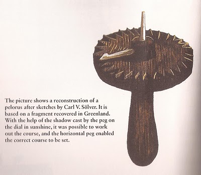
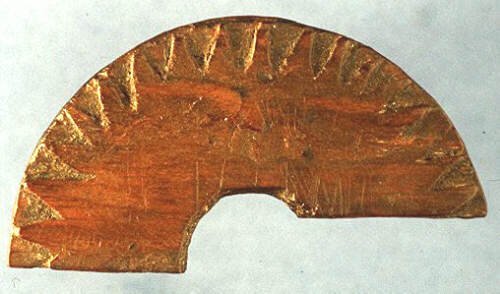
The pelorus, similar to the ones used today, was an instrument much like a mariner’s compass, but without magnetic needles. It had two sight vanes and was mounted in such a way that the bearings of objects could be observed.
The bearing dial or bearing circle was used to determine the latitude of the sun. It had a small platform with a vertical pin in the middle and a pointer, and it was used to track the position of the sun in the sky by marking the placement of shadows on the platform.
The sun shadow board was used at noon to double check whether the ship was on the correct course or not. It was placed in a bowl of water to keep it level and the gnomen, the pin in the center of the board, marked the shadow of the noon sun. Circles marked on the board gave the sailors an area in which they could travel and still remain within their desired latitude. If the shadow of the noon sun extended beyond the circle, they knew they had traveled too far north. If the shadow was inside the line, they were too far south. The sun shadow board’s midday measurement helped the Vikings make course corrections each noon, but was of no use to the sailors in cloudy or foggy weather.
The sun stone was used on the days when fog or clouds obscured the sun. The stone, a mineral called Icelandic spar, would change color as it was turned in the light. A certain color would indicate the position of the sun through the fog or clouds but could only be used when there was at least a sliver of blue sky.
The semi-wheel was a chart that recorded the year-round observations of the sun and measurements of its positions. The Vikings of Iceland collected this data, also noting where on the horizon the sun rose and set each day. This collection of information was used to determine their latitude as well as the cardinal directions, North, South, East and West.
The sun compass recorded the different paths the sun took across the sky during the different seasons of the year. By drawing these different hyperbolas on the face of the sun compass, the Vikings had a record of the sun’s position for each time of year. They were able to determine, with great accuracy and at any time of day, their position at sea by rotating the disk of the sun compass until the shadow of the tip in the center of the compass fell on the hyperbola for that time of year.
|